

We often hear that we need to restore ecosystems and construct living shorelines projects because these ecosystems provide ecosystem functions and services. These two terms (ecosystem functions and ecosystems services) are mentioned in almost any article or presentation related to restoration and living shorelines projects and are rarely defined and often confused with each other. These terms are confusing because they essentially have the same definition, with one key difference that can be a major factor for stakeholder engagement.
Ecosystem functions can be simply defined as the processes that occur within an ecosystem.
Ecosystem services can be defined as ecosystem functions that directly or indirectly benefit humankind, which gives them an inherent value to us.
The acronym NRDA is also often mentioned, but rarely defined, so it warrants some explanation too. NRDA stands for Natural Resource Damage Assessment and is a process that NOAA’s DARRP (Damage Assessment, Remediation, and Restoration Program) and co-trustees (e.g., state agencies and other federal agencies) use to assess and restore damaged ecosystems. The NRDA process is being used to restore the areas affected by the Deepwater Horizon Oil Spill. DAARP has announced that several large-scale restoration and living shorelines projects will be funded in this region.
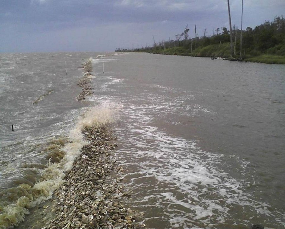
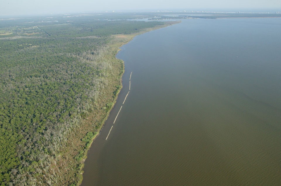
In coastal Alabama, there are two proposed projects that I would like to discuss. One of these projects will be located along the Portersville Bay shoreline in Mobile County and will include the installation of three living shorelines sections (Shell Belt Road, Coden Belt Road, and Point aux Pins Peninsula) totaling approximately 2 linear miles.
The other Alabama project will be located on the eastern edge of Bon Secour Bay and inside the Weeks Bay National Estuarine Research Reserve (WBNERR) boundary. This project will cover the installation of 1.6 linear miles of living shorelines adjacent to a previously installed living shorelines project led by The Nature Conservancy and WBNERR. I’m excited to see how these projects progress relative to each other. Since several different living shorelines techniques will be implemented through these projects, we will be able to see how effective each technique is and learn from these projects to better refine the living shorelines process. You can find additional information for all of these projects at the links on this page to the left of this story.
Meet the author

Eric Sparks, Ph.D.
Assistant Director for Outreach and Coastal Ecology Specialist
Eric is the assistant director for outreach and a coastal ecology specialist. His work focuses on estuarine and wetland issues, and his specialty areas include coastal conservation and... Read more
Phone: 228-546-1025
Email: [email protected]